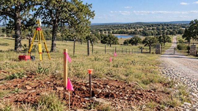
A boundary survey can change how you see a rural property
Rural land listings often look simple on an online map: a clean polygon, a stated acreage, a road along one side, and fences that appear to match the boundary.
In the field, the legal boundary may be based on section corners, monuments, metes-and-bounds calls, subdivision plats, road records, easements, and decades of survey evidence that do not line up perfectly with the visual clues.
Before closing, a professional boundary survey can reveal whether the acreage, corners, access, fences, improvements, and planned homesite actually fit the legal parcel you are buying.
Oklahoma has minimum standards for boundary surveys
Oklahoma's surveying rules require professional surveyors to research available records, analyze title boundary evidence, search for controlling corners, and make a careful determination of the record title boundary.
Those standards are designed to produce defensible boundary locations based on surveying and legal principles rather than a simple GPS trace or online parcel outline.
For buyers, that distinction matters because the survey is intended to reconcile records and field evidence, not merely redraw an assessor map.
A county GIS map is useful, but it is not the legal boundary
County assessor and GIS systems are excellent tools for finding parcel IDs, tax information, approximate shapes, neighboring parcels, and aerial context.
But GIS parcel lines are generally mapping representations built for assessment and administration, not a substitute for a field boundary survey.
Use the map to understand the property, then use recorded documents and a licensed surveyor when exact boundary location matters.
The deed description controls more than the listing acreage
A real estate listing may advertise 10 acres, 20 acres, or another rounded figure, but the legal description in the deed is what identifies the land being conveyed.
Oklahoma survey standards recognize several description types, including metes and bounds, aliquot descriptions using section-township-range, and lot-and-block descriptions tied to recorded plats.
If the legal description is vague, inconsistent, or difficult to locate on the ground, that is a reason to investigate before closing.
Section, township, and range descriptions are common in rural Oklahoma
Many Oklahoma rural tracts are described using the Public Land Survey System, with references to portions of a section, township, range, and principal meridian.
These descriptions can sound simple, such as a quarter-quarter section, but real-world boundaries may still depend on established section corners, historic measurements, road dedications, previous conveyances, and survey monuments.
Do not assume a mathematically perfect square on a map is the same thing as the legal boundary on the ground.
Metes-and-bounds descriptions deserve careful review
A metes-and-bounds description follows courses and distances from a point of beginning.
Oklahoma standards require such descriptions prepared by surveyors to contain enough information to locate the property, return to the point of beginning, and mathematically close.
Older descriptions can contain ambiguous calls, outdated monument references, transcription errors, or measurements that require professional interpretation.
Property corners matter because future decisions depend on them
A corner controls more than where a fence post belongs.
Corner locations can affect house setbacks, driveway placement, utility easements, septic areas, barns, ponds, gates, timber clearing, hunting boundaries, and whether an improvement crosses onto neighboring land.
Oklahoma standards require surveyors to establish or confirm monuments at property corners, with witness or reference monuments used when direct placement is impractical.
Monuments can be pipes, pins, stones, caps, or other evidence
Property corners are not always marked with a bright new rebar and cap.
Depending on the survey history, a controlling corner might be an iron pin, pipe, stone, concrete monument, section corner, brass cap, fence intersection, or another accepted monument referenced in prior records.
Do not move, replace, or assume a found object is the corner without understanding its survey significance.
Old fences are evidence, not automatic proof of ownership
Rural fences often follow property boundaries, but they can also follow terrain, livestock needs, old agreements, convenience, road changes, or historic use.
A fence can sit several feet or much farther from the record line and still have existed for decades.
Treat fence location as important field evidence, but do not assume the fence is the legal line without survey and title review.
Acreage numbers can change after a proper survey
Listing acreage, assessor acreage, deed acreage, and surveyed acreage do not always match exactly.
Differences can result from old measurement methods, road rights-of-way, prior conveyances, gaps or overlaps, deed language, water boundaries, or simple rounding.
The key question is not only how many acres the listing says, but whether the survey and title documents describe the same land you expect to own.
Small acreage discrepancies can matter on a narrow tract
A one-acre difference on a 100-acre ranch may be less disruptive than a small dimensional error on a narrow five-acre homesite.
On constrained property, a boundary shift can affect septic separation, building setbacks, driveway access, well spacing, shop placement, or the ability to divide the land later.
Evaluate acreage differences in the context of the planned use, not just as a percentage of the total purchase.
Road frontage should be measured against the legal boundary
A parcel can appear to have generous road frontage on a map while the legal description, right-of-way, access easement, or actual road alignment tells a more complicated story.
The survey should show relevant physical roadway evidence and, where applicable, adjoining section-line rights-of-way or recorded road information.
If the driveway location is important to your build plan, confirm the legal frontage and access corridor before closing.
Physical access and legal access are different questions
A dirt road leading to the property does not automatically prove a permanent legal right to use it.
The road could cross private land under an easement, informal permission, historic use, or no recorded right at all.
Have the title work and survey reviewed together so the physical road can be compared with the recorded access rights.
Recorded easements can reduce the usable area
Utility, pipeline, road, drainage, conservation, access, and other easements can limit where structures, fences, ponds, trees, or septic components can be placed.
Some easements are clearly shown on subdivision plats, while others appear in separately recorded documents referenced by the title commitment.
Give the surveyor the easement documents you want plotted so the site plan reflects the actual burdens on the property.
Utility easements deserve attention before choosing the homesite
Overhead and underground utility easements may follow roads, property lines, or routes across the interior of the tract.
A future shop, pool, barn, driveway, or house pad can conflict with those corridors if the easement is ignored.
Coordinate survey, title, utility planning, and the preliminary site plan before locking in the structure locations.
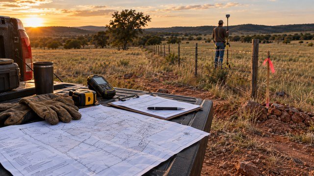
Pipeline and energy corridors can have broad rights
Oklahoma rural property can be affected by oil, gas, pipeline, electric transmission, and related easements.
The visible pipe or line is only part of the issue. The recorded easement may include access, maintenance, clearing, replacement, or width provisions that extend beyond the physical facility.
Review the actual easement language rather than estimating the burden from aerial imagery.
Mineral ownership is separate from the surface boundary survey
A boundary survey establishes the surface tract being surveyed, but it does not by itself tell you who owns the oil, gas, or other mineral interests beneath the land.
Oklahoma properties frequently have severed mineral ownership or historic oil and gas interests.
If mineral rights matter to the purchase, handle that through title and mineral research in addition to the surface survey.
A title commitment and a survey solve different problems
The title commitment identifies recorded interests, exceptions, liens, easements, and other matters that may affect title coverage.
The survey shows how the boundary and relevant physical evidence fit on the ground.
The most useful due diligence happens when the surveyor, title company, buyer, and real estate professionals are working from the same legal description and exception documents.
Ask the title company which exceptions need to be located
A title commitment can contain multiple easement and right-of-way exceptions.
Some may be clearly locatable from recorded descriptions, while others may be blanket exceptions or historical documents that are difficult to map.
If a title policy endorsement or lender requires certain matters shown, give the surveyor those documents early rather than after the fieldwork is complete.
Mortgage inspections are not the same as boundary surveys
Oklahoma surveying rules separately address mortgage inspection reports.
A mortgage inspection may help a lender evaluate visible improvements relative to apparent lines, but it is not a substitute for a full boundary survey intended to establish the property boundary.
If you need corners located, acreage confirmed, easements plotted, or a buildable area evaluated, make sure you are ordering the correct survey service.
ALTA/NSPS surveys are usually more detailed
Commercial, development, or complex financing transactions may call for an ALTA/NSPS Land Title Survey in addition to Oklahoma's minimum standards.
These surveys can address a broader set of title, access, improvement, and optional Table A items when requested by the parties.
Most simple rural residential purchases may not need an ALTA survey, but large or complicated tracts can benefit from the added detail.
Surveys become especially valuable before dividing land
If you plan to split acreage, create family homesites, sell off frontage, or carve out a shop tract, the original parcel boundary needs to be understood first.
A new division can create frontage, access, utility, zoning, septic, and legal-description issues that were not important when the parcel was held as one tract.
Discuss the future split with the surveyor before the initial survey so useful control and monumentation can be preserved.
A survey can reveal encroachments before they become your problem
Barns, sheds, fences, driveways, septic components, ponds, corrals, utility lines, and even houses can cross or approach a boundary unexpectedly.
It is better to discover an encroachment during due diligence than after closing when you are trying to build, finance, insure, or resell the property.
When improvements near the line matter, ask for them to be located and shown.
Ponds and creeks can complicate visual boundary assumptions
Natural features move, and property descriptions do not always follow the center of a creek or edge of a pond.
A fence around a pond or a creek used as a practical livestock boundary may not match the legal parcel line.
If water features are near the edge of the tract, understand whether they are merely physical features or part of the legal description.
Do not clear trees or build fence before the corners are known
Clearing to the wrong line can create expensive neighbor disputes and destroy survey evidence that would otherwise help establish the boundary.
New fencing can also make a bad assumption look more permanent.
Locate and protect the corners before major clearing, grading, road building, or fence installation near the perimeter.
Construction staking is different from a boundary survey
Once the boundary is established, a surveyor may provide additional staking for the house, driveway, shop, septic area, elevation, or other construction features.
Those services use the boundary framework but serve a different purpose from establishing ownership lines.
Discuss the entire development plan so survey work can be sequenced efficiently.
Topographic information can improve rural site planning
A boundary survey tells you where the parcel is, while topographic work shows elevations and terrain.
For steep, drainage-sensitive, or heavily developed acreage, combining boundary and topographic information can help with house-pad elevation, driveway grades, pond design, drainage, and utility routes.
You may not need full topo mapping for every rural purchase, but it can save redesign on complicated sites.
Survey timing matters during the purchase contract
Boundary surveys can take time, especially on large tracts with old descriptions, missing monuments, difficult terrain, or heavy research requirements.
If the survey is important to your purchase decision, make sure the contract gives enough time to complete the work and resolve material issues.
Waiting until the final days before closing can leave little room to renegotiate or investigate a discrepancy.
Survey cost depends on complexity more than acreage alone
A large rectangular tract with good monuments and clean records may be easier than a small irregular parcel with conflicting descriptions and missing corners.
Travel, vegetation, terrain, research, number of corners, easements, road records, access, required deliverables, and urgency all affect price.
Ask surveyors for a scope-based quote rather than assuming a simple per-acre rate.
What to give the surveyor
The surveyor can work more efficiently when the buyer provides complete transaction documents.
- Current deed or legal description
- Title commitment
- Recorded easement documents
- Prior surveys if available
- Subdivision plat if applicable
- Purchase contract or parcel exhibit
- Known access agreements
- Locations of planned house, driveway, shop or other improvements
- Any boundary concerns raised by the seller or neighbors
- Contact information for the title company or closing agent
Questions to ask before ordering the survey
Be specific about what you need from the final product.
- Is this a full boundary survey?
- Will all corners be found or set as required?
- Will fences and visible improvements near the boundary be shown?
- Can recorded easements from the title commitment be plotted?
- Will road frontage and access evidence be shown?
- Can acreage be calculated from the surveyed boundary?
- Do I need topographic or construction staking too?
- What documents do you need from the title company?
- What is the expected fieldwork and delivery timeline?
- What will I receive at completion?
Questions to answer before closing
The survey should be used as a decision document, not filed away unread.
- Does the surveyed boundary match what I thought I was buying?
- Does the acreage differ materially from the listing or deed?
- Are all corners identifiable?
- Do fences follow the boundary?
- Are there encroachments?
- Is the driveway entirely within the property or a valid easement?
- Do recorded easements cross the planned homesite?
- Is there enough buildable area after setbacks and easements?
- Are ponds, barns, shops or utilities where I expected them?
- Does any issue need to be resolved by the seller before closing?
The bottom line
For Oklahoma rural land, online parcel maps and fences are useful orientation tools, but they are not replacements for professional boundary work when exact lines matter.
Oklahoma's surveying standards require research, field evidence, corner work, and a defensible boundary determination, which is exactly why a survey can uncover issues that a listing map cannot.
Before closing on acreage you plan to build on, use the survey together with the title commitment and site plan so you know what land you are buying, how you can legally access it, and where your future improvements can safely fit.
Keep researching
Acreage Planning resources
Due diligence, development sequencing, utilities, access, and the decisions that shape a rural property project.
Sources & methodology
Where this information comes from
Cost figures are planning references rather than contractor quotes. Permitting, system-selection, and location-specific guidance should be verified with the appropriate local authority or qualified professional. AcreageReady uses source-backed, AI-assisted editorial workflows and remains responsible for the material it publishes. Read how we research, edit, and correct guides.
- Oklahoma State Board of Licensure: Minimum Standards for Surveying
- Oklahoma State Board of Licensure: Engineer & Surveyor Resources
- Oklahoma State Board of Licensure: Administrative Rules
- Oklahoma State Board of Licensure: Surveyor Licensing Qualifications
- AcreageReady: Buying Rural Land in Oklahoma
- AcreageReady: Oklahoma Zoning & Building Permits
- AcreageReady: Oklahoma Rural Driveway Costs
Common questions
Frequently asked questions
Do I need a survey before buying rural land in Oklahoma?
A survey is not required for every transaction, but it can be extremely valuable when boundaries, acreage, access, easements, fences, encroachments, or future construction matter. Buyers should discuss the need with their title company, lender, attorney, and licensed surveyor.
Are Oklahoma county GIS property lines accurate?
They can be useful for general orientation and tax mapping, but they should not be treated as a legal boundary determination. Exact boundary location should come from recorded documents and a professional boundary survey.
Does a fence establish the property line in Oklahoma?
Not automatically. A fence can be evidence of occupation or historic use, but it may not match the record boundary. A survey and, when necessary, legal review are the appropriate ways to evaluate a disputed or uncertain line.
Will an Oklahoma boundary survey mark the corners?
Oklahoma minimum standards require the professional surveyor to establish or confirm monuments at property corners, with witness or reference monuments used when placing a monument at the exact corner is impractical.
Can surveyed acreage differ from the deed or listing?
Yes. Differences can result from older measurements, road rights-of-way, prior conveyances, ambiguous descriptions, gaps or overlaps, or simple rounding. The importance of the difference depends on the tract and intended use.
Is a mortgage inspection the same as a boundary survey?
No. Oklahoma rules distinguish mortgage inspection reports from boundary surveys. A mortgage inspection should not be relied on when you need legal boundary determination, confirmed corners, acreage, easement plotting, or detailed site planning.
Should easements be shown on the survey?
Recorded easements can often be shown when the surveyor is provided the relevant title documents and descriptions. Tell the surveyor which easements and title exceptions need to be plotted.
How early should I order a rural land survey?
Order it early enough in the due-diligence period to allow fieldwork, record research, review, and resolution of any material issues before closing.
Ready to talk with a local professional?
Share your location and project details so AcreageReady can identify relevant providers as the network grows.
Get a free quote