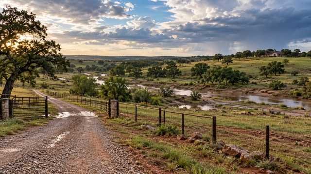
Flood risk can affect far more than the house pad
On rural Oklahoma land, flood risk can affect the driveway, septic system, well access, barns, shops, fencing, ponds, grading, culverts, and where fill can be placed.
A tract can contain both high ground and mapped floodplain, which means the key question is often not whether the parcel touches a flood zone, but whether the planned improvements can fit outside the problem areas.
Floodplain and drainage review should happen early in due diligence, before the homesite and driveway are finalized.
Start with the FEMA flood map, then verify locally
FEMA Flood Insurance Rate Maps identify mapped flood hazard areas, and Oklahoma's floodplain program points buyers to FEMA's National Flood Hazard Layer and Map Service Center for research.
The Oklahoma Water Resources Board also advises property owners to contact the local floodplain administrator for the final local determination.
Use online maps for screening, then confirm the parcel and proposed development with the local jurisdiction.
Zone A means a mapped one-percent-annual-chance flood hazard without detailed elevations
In Oklahoma, Zone A identifies areas with at least a one-percent annual chance of flooding where detailed hydraulic analysis and mapped base flood elevations may not be available.
That can make development planning more complicated because the applicant may need additional elevation or engineering information to establish the appropriate building elevation.
Do not assume that the absence of a printed base flood elevation makes Zone A easier to build in.
Zone AE has a mapped base flood elevation
Zone AE is also within the one-percent-annual-chance floodplain, but FEMA's detailed study provides base flood elevations.
Those elevations are important for building design, elevation certificates, floodplain permits, and insurance.
A surveyor or engineer may be needed to relate the proposed structure elevation to the mapped base flood elevation.
Zones AH and AO represent shallow flooding
Zone AH generally indicates shallow ponding with mapped base flood elevations, while Zone AO indicates shallow sheet-flow flooding with mapped flood depths.
These zones can look less dramatic than a river floodplain on an aerial image, but they can still affect construction and finished-floor requirements.
Shallow flooding can also make driveways, yards, septic components, and outbuildings difficult to keep usable during heavy rain.
Zone X does not mean zero flood risk
Zone X generally represents areas outside the mapped one-percent-annual-chance floodplain or areas of lower mapped flood risk.
That does not guarantee the property will never flood.
Localized drainage, undersized culverts, pond overflow, small creeks, intense rainfall, road overtopping, and unmapped drainage paths can create problems outside the Special Flood Hazard Area.
The regulatory floodway deserves special caution
The floodway is the part of the floodplain reserved to carry floodwater without causing unacceptable increases in flood elevation.
FEMA guidance requires development in an adopted regulatory floodway to demonstrate through hydrologic and hydraulic analysis that the project will cause no increase in base-flood levels.
Projects in a floodway can therefore require significantly more engineering and may be difficult or impractical for a rural homesite.
A floodplain permit can apply to more than buildings
Oklahoma floodplain guidance is clear that development can include more than constructing a house.
Clearing, grading, fill, mining, dredging, drilling, ditches, accessory structures, and other work in a mapped floodplain can require local floodplain review or permitting.
Do not assume you can move dirt first and address the permit later.
The local floodplain administrator is the key contact
Floodplain development permitting for private property is generally administered by the city, town, or county participating in the National Flood Insurance Program.
The Oklahoma Water Resources Board coordinates the state's NFIP participation and provides guidance, but it does not normally make local permitting decisions for privately owned land.
Ask the local floodplain administrator what maps, elevations, engineering, and permits apply to your specific parcel and project.
More than 400 Oklahoma communities participate in the NFIP
Oklahoma's floodplain program reports that more than 400 communities participate in the National Flood Insurance Program.
Participation allows communities to make federally backed flood insurance available while requiring local floodplain regulations that meet minimum federal standards.
Local communities can also adopt standards that are more restrictive than FEMA minimums.
An elevation certificate may be required for a new building
Oklahoma's model floodplain permit guidance states that new buildings in the Special Flood Hazard Area may require an Elevation Certificate documenting the building's elevation relative to the base flood elevation.
A licensed surveyor, engineer, or other authorized professional typically prepares the elevation information required by the form.
Include survey and elevation work in the development budget if the homesite is inside a mapped flood hazard area.
Freeboard can raise the required building elevation
Some communities require the lowest floor to be built above the FEMA base flood elevation by an additional safety margin known as freeboard.
Oklahoma publishes model floodplain ordinances that include higher-standard freeboard options, which shows that local rules can exceed minimum NFIP requirements.
Always ask the local floodplain administrator for the actual required elevation rather than designing only to the FEMA map.
Fill is not a simple way to remove flood risk
Adding fill can alter drainage patterns and flood storage, and it can affect neighboring property.
In a mapped floodplain, fill may require a development permit, engineering review, compaction specifications, or other documentation.
Do not assume that hauling in enough dirt to raise a house pad automatically makes the site compliant or insurable.
A Letter of Map Change can address certain mapping situations
If property or a structure appears to be mapped in a flood hazard area but better elevation information shows otherwise, FEMA has Letter of Map Change processes that may apply.
Oklahoma's floodplain FAQ directs owners who believe a map designation may be wrong to contact the local floodplain administrator about the appropriate FEMA process.
A map change is a technical and documentation process, not simply a request to redraw the line.
The lender's flood determination is separate from your site-planning decision
A mortgage lender may require flood insurance based on its flood-zone determination and federal lending rules.
That determination answers an insurance and lending question, but it does not tell you whether the driveway will wash out, the septic area will stay accessible, or drainage will damage the building pad.
A good rural-land review looks at both regulatory mapping and actual site drainage.
Flood insurance can still be worth considering outside the mapped high-risk zone
Properties outside the Special Flood Hazard Area can still experience flooding.
Rural drainage problems often come from small watersheds, road crossings, pond failures, clogged culverts, and intense storms that may not be obvious from the FEMA polygon alone.
Ask an insurance agent about available flood coverage if the property has meaningful drainage exposure even when a lender does not require it.
Walk the property after rain if you can
A dry-weather showing can hide the most important drainage clues.
After rainfall, look for standing water, flowing swales, saturated ground, debris lines, sediment deposits, eroded banks, wet road crossings, and pond overflow paths.
If you cannot visit after a storm, ask neighbors, the seller, and local contractors about known drainage behavior.
Look beyond the creek itself
Flooding does not require a major river.
Small creeks, intermittent channels, roadside ditches, broad swales, low spots, and drainage from uphill acreage can move large amounts of water during Oklahoma thunderstorms.
Trace where water enters the property, where it concentrates, and where it leaves.
The driveway is often the first thing to flood
A homesite may sit safely on high ground while the only access road crosses a low drainage area.
If the driveway or bridge becomes impassable, the property can be effectively isolated even when the house stays dry.
Review low-water crossings, culverts, bridge elevations, roadside ditches, and alternative emergency access before choosing a distant homesite.
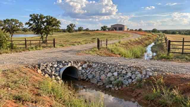
Culvert size should follow drainage, not convenience
An undersized culvert can back water onto the road, overtop the driveway, erode fill, or redirect flow toward neighboring property.
Large rural watersheds can require substantial drainage structures even when the channel looks small in dry weather.
For important crossings, use the road authority's requirements and appropriate engineering rather than selecting pipe size only by price.
Ponds need a safe overflow path
A pond can be an asset, but it also concentrates water.
Buyers should understand the normal pool elevation, spillway, emergency overflow route, dam condition, upstream watershed, and whether overflow could cross the driveway or proposed homesite.
A poorly located house, shop, or driveway below a pond can create avoidable risk.
Do not block natural drainage with the house pad
A raised pad or long driveway can function like a small dam if it crosses a swale without enough drainage.
Water that used to spread across a field may become concentrated against the new fill or redirected toward a neighbor.
Coordinate grading, culverts, ditches, and final elevations as one drainage system.
County roads can send water onto private land
Roadside ditches and cross-drain culverts can discharge stormwater onto or near rural property.
A tract may look dry until a large storm sends runoff from the public road through an existing drainage path.
Walk the road frontage and identify every culvert, ditch, and low point before placing the driveway or house.
Expansive clay and poor drainage can create problems without a mapped floodplain
Some Oklahoma soils hold water and drain slowly, which can create saturated yards, driveway rutting, foundation concerns, and septic limitations.
These are site-drainage and soil issues rather than FEMA flood-zone classifications.
Soil evaluation, grading design, and site observation are important even when the parcel is outside mapped flood hazards.
Flood maps can change over time
FEMA maps are updated as communities receive new studies, topography, hydrology, or mapping projects.
A parcel that is outside a mapped hazard area today can be affected by a future revision, and older maps may not reflect recent development upstream.
Check the effective map and ask whether preliminary or updated studies are available.
Base Level Engineering can provide additional screening information
Oklahoma floodplain resources include tools and model information that can help communities and property owners understand flood risk in areas where detailed studies may be limited.
These tools can be useful for screening but do not replace the local floodplain administrator's determination or any engineering required for a permit.
Use them as additional evidence when evaluating large rural parcels with uncertain drainage.
Floodplain boundaries can split a parcel
Many rural tracts are only partly within a mapped flood hazard area.
That can still leave enough high ground for the house, septic system, well, shop, and driveway if the layout is planned carefully.
The important step is overlaying the flood information with the survey and proposed site plan rather than rejecting or accepting the parcel based on a single map label.
A floodway on one corner of a large tract may be manageable
If the floodway follows a creek along the edge of a large parcel and all planned improvements can remain well outside it, the impact may be limited.
But if the only driveway, bridge, utility route, or buildable pad must cross that floodway, the project can become much more complex.
Evaluate how the hazard affects the development path, not just how many acres it covers.
Ask whether prior owners placed fill or changed drainage
Historic grading, pond construction, channel work, berms, and road building can alter runoff.
Unpermitted or poorly documented work can become a problem when you apply for new development approvals.
Compare current topography with older aerial imagery and ask about previous drainage projects when something looks altered.
Drainage easements can limit the homesite
A recorded drainage easement may reserve an area for channels, stormwater, or maintenance access.
Even if the easement appears dry most of the year, structures or fill may be restricted within it.
Review title documents and have significant drainage easements shown on the survey.
The septic system should be planned with flood risk in mind
Wastewater systems need suitable soil, setbacks, and an area that can function reliably.
Flood-prone or saturated ground can reduce the practical septic area and complicate access for installation or repair.
Coordinate floodplain review with the septic evaluation before committing to a homesite.
The well and electrical equipment also need resilient locations
A wellhead, pump equipment, transformer, meter pedestal, generator, and other infrastructure should not be placed in obvious drainage paths if avoidable.
Even when the house is elevated, damaged utilities can make the property unusable after a storm.
Plan critical systems on stable, accessible ground and follow applicable floodplain and utility requirements.
Questions to ask the local floodplain administrator
A short call with the local floodplain administrator can save major redesign later.
- Is any part of this parcel in a Special Flood Hazard Area?
- Which FEMA map panel and effective date apply?
- Is there a regulatory floodway on the property?
- What floodplain development permit is required?
- What base flood elevation applies?
- Is freeboard required?
- Will an Elevation Certificate be required?
- Can fill be placed in the proposed area?
- Would grading, clearing, a driveway, culvert, pond, or shop require review?
- Is a no-rise certification required for any proposed work?
- Are there preliminary maps or newer flood studies?
- What inspections or as-built documents are required?
Questions to answer before closing
Flood due diligence should end with a clear development picture.
- Can the house, septic system, well, shop, and driveway all fit on usable high ground?
- Does the only access route cross a floodplain or floodway?
- Are there low-water crossings or undersized culverts?
- Where does runoff enter and leave the property?
- Are ponds or dams upstream of the homesite?
- Are there drainage easements?
- Will floodplain permits add engineering cost?
- Will the lender require flood insurance?
- Has the seller experienced road or property flooding?
- Is there enough elevation difference to create positive drainage around the future house?
The bottom line
FEMA flood maps are an essential first screen for Oklahoma acreage, but they are only one part of the drainage picture.
A good rural-land review combines the FEMA map, local floodplain administrator guidance, survey, site elevations, road and culvert conditions, actual drainage paths, and the proposed development layout.
Before closing, make sure the property has a practical high-ground plan for the house and infrastructure and that the driveway remains usable when Oklahoma gets its heaviest rain.
Keep researching
Acreage Planning resources
Due diligence, development sequencing, utilities, access, and the decisions that shape a rural property project.
Sources & methodology
Where this information comes from
Cost figures are planning references rather than contractor quotes. Permitting, system-selection, and location-specific guidance should be verified with the appropriate local authority or qualified professional. AcreageReady uses source-backed, AI-assisted editorial workflows and remains responsible for the material it publishes. Read how we research, edit, and correct guides.
- Oklahoma Water Resources Board: Floodplain Management
- Oklahoma Water Resources Board: Floodplain Management FAQ
- Oklahoma Water Resources Board: Forms & Guidance
- Oklahoma Water Resources Board: 2024 Oklahoma NFIP Quick Guide
- Oklahoma Water Resources Board: Model Floodplain Development Permit Application
- FEMA: Floodway Analysis and Mapping Guidance
- FEMA: Map Service Center
- AcreageReady: Buying Rural Land in Oklahoma
- AcreageReady: Oklahoma Rural Driveway Costs
- AcreageReady: Oklahoma Easements & Legal Access
Common questions
Frequently asked questions
How do I find out if rural property in Oklahoma is in a flood zone?
Start with FEMA's National Flood Hazard Layer or Map Service Center, then contact the local floodplain administrator for the city, town, or county. Oklahoma's OWRB recommends the local floodplain administrator for the final local determination.
Can I build a house in an Oklahoma floodplain?
Possibly, depending on the flood zone, local ordinance, required building elevation, floodway status, engineering, and permit conditions. Contact the local floodplain administrator before designing or grading the site.
Do I need a permit just to add fill or grade land in a floodplain?
Potentially yes. Oklahoma's floodplain development guidance treats activities such as fill, grading, clearing, dredging, drilling, and ditch work as development that may require local floodplain review or a permit.
What is a regulatory floodway?
It is the part of the floodplain reserved to convey floodwater. Development there is heavily restricted and typically requires engineering showing no increase in base-flood elevation.
Does Zone X mean the property cannot flood?
No. Zone X is generally lower mapped flood risk than the Special Flood Hazard Area, but localized drainage, ponding, culvert failures, small streams, and extreme rainfall can still cause flooding.
What is a base flood elevation?
The base flood elevation is the computed elevation of the one-percent-annual-chance flood. It is used in floodplain development, building elevation, and insurance decisions in mapped areas where a BFE is available.
What is an Elevation Certificate?
It is a FEMA form documenting building elevation information relative to mapped flood data. New buildings in mapped high-risk areas may need one for local floodplain compliance or insurance purposes.
Who regulates floodplain development on private land in Oklahoma?
For most private property, the local participating city, town, or county administers floodplain development requirements through its floodplain administrator. OWRB coordinates the state's NFIP program and regulates state-owned or state-operated property.
Ready to talk with a local professional?
Share your location and project details so AcreageReady can identify relevant providers as the network grows.
Get a free quote