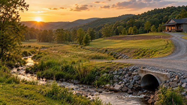
Flood risk can affect buildability even when most of the parcel looks dry
A rural Tennessee property can contain excellent building ground and still have flood-risk or drainage problems that affect the driveway, septic system, well, utilities, pasture, pond, or future structures.
Flood risk is not limited to land directly beside a major river. Small creeks, drainage swales, low areas, steep watersheds, and concentrated runoff can create problems during heavy rain.
The goal during due diligence is to understand both mapped flood hazards and the way water actually moves across the site.
Start with the FEMA flood map, but do not stop there
FEMA flood maps are the standard starting point for identifying mapped Special Flood Hazard Areas and other flood zones.
Use the parcel address or map location to review the current Flood Insurance Rate Map, then compare the mapped flood areas with the actual homesite, driveway, and other planned improvements.
A parcel being mostly outside a mapped flood zone does not automatically mean every part of it is suitable for development.
Tennessee floodplain development is managed locally
The Tennessee Emergency Management Agency explains that floodplain development requirements are managed locally through participating communities.
Each participating city or county has a local floodplain administrator who can answer property-specific questions about permits, development requirements, elevation certificates, floodplain determinations, and local standards.
If the parcel is outside city limits, the county floodplain administrator is generally the right starting point. Inside city limits, contact the city.
Know what the common FEMA flood-zone labels mean
Zones beginning with A or V generally identify higher-risk areas within the Special Flood Hazard Area, while Zone X can represent either moderate or minimal mapped flood risk depending on how it is shown.
The map should be read with its legend and supporting information rather than relying on the letter alone.
If the home, driveway, or other improvement is near a mapped boundary, consider getting professional confirmation of the site elevation and floodplain relationship.
The 1-percent annual chance flood is not a once-in-100-years promise
The term 100-year flood is commonly misunderstood.
It refers to a flood that has a 1 percent chance of being equaled or exceeded in any given year, not a flood that can happen only once every 100 years.
Several major floods can occur within a short period, and properties outside the mapped high-risk area can still flood.
A floodplain can reduce the practical building envelope
Even when building is legally possible, a floodplain can limit where the home, shop, septic system, driveway, fill, or other improvements should go.
The usable portion of a parcel may be much smaller than the advertised acreage once floodplain, setbacks, steep slopes, easements, and septic areas are considered together.
Overlay the flood map with a current survey or site plan before deciding where to build.
Floodway and floodplain are not the same thing
A regulatory floodway is the portion of the floodplain reserved to carry floodwater without causing unacceptable increases in flood levels.
Development in or near a floodway is generally much more restrictive because fill, buildings, bridges, culverts, and other obstructions can alter how water moves.
If the parcel contains a mapped floodway, discuss the proposed project with the local floodplain administrator before assuming the area can be improved.
Ask whether a floodplain development permit is required
Communities participating in the National Flood Insurance Program typically regulate development within mapped flood hazard areas.
Development can include more than constructing a house. Fill, grading, storage, accessory buildings, road work, culverts, and other changes can also be regulated.
The local floodplain administrator can tell you what permit or review applies to the specific parcel and project.
An Elevation Certificate can be important for some projects
An Elevation Certificate documents building and site elevations in relation to mapped flood information.
It may be requested for floodplain development review, flood insurance, or other documentation depending on the project and community.
If the proposed structure is close to a mapped flood elevation, ask the local administrator and surveyor whether an Elevation Certificate is appropriate.
Flood maps can change
FEMA maps are updated over time as communities receive new topographic, hydrologic, and hydraulic information.
Do not assume an old survey, listing attachment, or seller-provided map is the current effective map.
Check the current map and ask about any pending map changes if floodplain status is material to the purchase.
A creek is not the only drainage feature that matters
Rural Tennessee properties often contain dry swales, wet-weather conveyances, springs, gullies, roadside ditches, ponds, and low depressions.
Some of these features carry large volumes of water only during storms, which makes them easy to underestimate during a dry property showing.
Walk the land after rain when possible and look for water stains, sediment deposits, debris lines, scoured soil, washed gravel, and saturated ground.
Topography can reveal drainage problems before you visit
Topographic maps and elevation data can help identify ridges, valleys, low points, and steep drainage paths.
A homesite located below a large uphill drainage area can receive significant runoff even if it is not inside a mapped FEMA flood zone.
Use mapping as a screening tool, then confirm site conditions on the ground.
Roadside ditches and culverts can control whether the driveway survives storms
A rural driveway often crosses a roadside drainage ditch, which means the entrance culvert becomes part of the property's stormwater system.
An undersized, poorly placed, or clogged culvert can cause water to back up, overtop the driveway, or wash out the entrance.
Ask the responsible road authority what culvert and drainage requirements apply before installing or modifying the entrance.
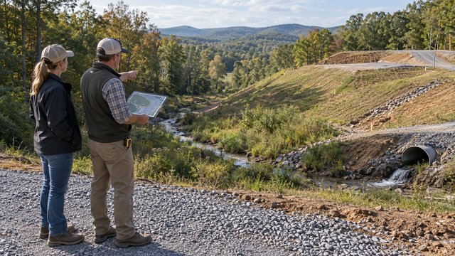
Long driveways need their own drainage plan
Water running down a long gravel driveway can create ruts, washouts, and repeated maintenance costs.
Crowns, cross slopes, side ditches, water bars, cross drains, culverts, and stable outlets may be needed depending on the grade and drainage area.
The driveway should shed water frequently rather than becoming the easiest path for runoff.
House-pad elevation matters even outside mapped flood zones
A house can sit outside the FEMA floodplain and still experience drainage problems if the surrounding grade directs water toward the foundation.
The finished site should generally move water away from the building and avoid trapping runoff behind retaining walls, patios, or landscaping.
Coordinate the house pad, driveway, swales, roof drainage, and final grading as one system.
Do not create drainage problems for neighboring property
Changing grades, filling low areas, building berms, or concentrating runoff can affect adjacent land.
A site-development plan should account for where water currently enters and leaves the property and how construction will change that pattern.
If significant drainage changes are planned, professional design may be worth the cost.
Steep Tennessee terrain can increase both runoff speed and erosion
Sloped land sheds water faster, which can increase erosion in ditches, swales, driveway cuts, and newly graded areas.
The steeper the terrain, the more important it becomes to stabilize disturbed soil quickly and provide safe outlets for concentrated flow.
This is especially relevant for hilltop or ridge homesites with long driveways.
One acre of disturbance is an important construction-stormwater threshold
Tennessee's construction stormwater program generally requires permit coverage when clearing, grading, or excavation disturbs one acre or more.
Projects disturbing less than one acre may also require coverage when they are part of a larger common plan of development or sale that reaches at least one acre.
Count the full disturbance area, including the driveway, house pad, septic work, utilities, clearing, and grading.
Erosion controls protect both the site and downstream property
Tennessee's current erosion and sediment-control guidance includes practices such as stabilized construction entrances, silt fence, sediment barriers, check dams, temporary seeding, mulch, and erosion-control blankets.
The correct controls depend on slope, soil, drainage area, construction sequencing, and site conditions.
Good erosion control prevents topsoil and sediment from leaving the property while the site is vulnerable.
Work in streams or wet-weather conveyances may require additional permits
Tennessee regulates certain activities that alter streams, wetlands, and other water resources through the Division of Water Resources.
A driveway crossing, culvert, fill placement, channel alteration, or similar project can require review depending on the feature and work involved.
Do not move or fill a stream channel simply because it is small or dry during part of the year.
Septic and drainage planning must work together
A septic field needs suitable soil and a site protected from damaging runoff and unnecessary disturbance.
Low, saturated, or flood-prone areas can complicate septic planning, while aggressive grading can change drainage across the approved disposal area.
Coordinate the floodplain review, septic evaluation, house site, driveway, and drainage plan before moving dirt.
Well placement also deserves flood-risk review
A private well should be planned where it can be protected from contamination and physical damage.
If the proposed well location is near a flood-prone area, creek, or drainage path, discuss the location and construction details with the well professional.
The well, septic system, and house should be laid out together instead of as separate projects.
Ponds and dams can change how water behaves on acreage
An existing pond can be a major property feature, but buyers should understand where overflow goes, whether the dam is stable, and how the pond interacts with the rest of the drainage system.
A failed spillway or blocked outlet can create erosion and flooding downstream.
If the pond or dam is substantial or appears poorly maintained, additional inspection may be appropriate.
Flood insurance is a separate decision from buildability
A parcel can be legally buildable and still have meaningful flood risk.
Lenders may require flood insurance for structures in certain mapped high-risk areas, but owners outside those areas can still choose to purchase coverage.
Use insurance requirements as one input, not as the only measure of whether flooding matters.
Seller disclosures and neighbor knowledge can add useful context
Ask whether the seller has experienced flooding, washouts, standing water, driveway failures, culvert replacement, or drainage repairs.
Neighbors can sometimes identify roads, bridges, or low areas that flood during major storms.
Treat these conversations as supplemental information and verify important issues independently.
Questions to ask the local floodplain administrator
Use the parcel number and a site map when possible so the answers are specific.
- Is any part of this parcel in a mapped Special Flood Hazard Area?
- Is there a regulatory floodway on or near the parcel?
- What floodplain ordinance applies here?
- Would my proposed home or shop require a floodplain development permit?
- Are there local freeboard or elevation requirements?
- Would fill be allowed in the proposed area?
- Is an Elevation Certificate required?
- Are there pending FEMA map revisions?
- Does the driveway or culvert need separate floodplain review?
- Are there additional local drainage or stormwater requirements?
Rural Tennessee flood and drainage due-diligence checklist
Before closing, combine map research with an on-site review.
- Check the current FEMA flood map
- Identify mapped floodplain and floodway areas
- Contact the local floodplain administrator
- Review the parcel survey and topography
- Walk creeks, gullies, low areas, and drainage swales
- Look for erosion, debris lines, and sediment deposits
- Check the road entrance and culvert
- Evaluate driveway drainage
- Confirm the proposed house-pad elevation
- Coordinate septic and well locations
- Identify ponds, dams, or spillways
- Estimate total disturbed acreage
- Determine whether construction stormwater permit coverage may apply
- Ask whether stream or wetland impacts require review
- Get professional drainage or engineering help when the site is complicated
The cheapest parcel can become expensive if water is fighting the site plan
Water affects nearly every part of rural development: the driveway, foundation, septic system, well, utilities, erosion control, landscaping, and long-term maintenance.
A good Tennessee acreage purchase does not just ask whether the house is outside the FEMA flood zone. It asks where water comes from, where it goes, and whether the planned development will work with that pattern.
Solving those questions before closing is usually cheaper than trying to repair drainage problems after construction.
Keep researching
Acreage Planning resources
Due diligence, development sequencing, utilities, access, and the decisions that shape a rural property project.
Sources & methodology
Where this information comes from
Cost figures are planning references rather than contractor quotes. Permitting, system-selection, and location-specific guidance should be verified with the appropriate local authority or qualified professional. AcreageReady uses source-backed, AI-assisted editorial workflows and remains responsible for the material it publishes. Read how we research, edit, and correct guides.
- TEMA: Floodplain Management
- TEMA: Statewide Floodplain Administrator Directory
- FEMA: Flood Map Service Center
- TDEC: NPDES Stormwater Construction Permit
- TDEC: Erosion Prevention & Sediment Control Handbook
- AcreageReady: Buying Rural Land in Tennessee
- AcreageReady: Tennessee Rural Driveway Costs
- AcreageReady: Tennessee Land Clearing & Grading Costs
Common questions
Frequently asked questions
How do I check whether rural Tennessee land is in a flood zone?
Start with the current FEMA flood map for the parcel, then contact the local city or county floodplain administrator for property-specific requirements and confirmation.
Can I build a house in a Tennessee floodplain?
Possibly, depending on the flood zone, floodway status, local ordinance, elevation, and proposed construction. Contact the local floodplain administrator before assuming the site is buildable.
What is the difference between a floodplain and a floodway?
The floodplain is the broader area subject to flooding, while the regulatory floodway is the portion reserved to convey floodwater without causing unacceptable increases in flood levels. Development in a floodway is typically more restricted.
Is Zone X completely flood-free?
No. Zone X generally represents lower mapped flood risk than the Special Flood Hazard Area, but flooding can still occur from local drainage, small streams, intense rainfall, or events larger than the mapped standard.
Do I need a stormwater permit for a rural house project in Tennessee?
Tennessee generally requires construction stormwater permit coverage for qualifying clearing, grading, or excavation that disturbs one acre or more, including smaller sites that are part of a larger common plan reaching that threshold.
Can I install a culvert across a creek on my property?
Potentially, but stream or water-resource impacts can require state, federal, or local review. Check with the appropriate authorities before altering a channel or installing a crossing.
Should I visit rural property after heavy rain before buying?
If possible, yes. Wet-weather conditions can reveal drainage paths, standing water, driveway problems, erosion, saturated areas, and culvert issues that may be difficult to see during dry weather.
Who handles floodplain questions in Tennessee?
Floodplain development requirements are managed locally. TEMA maintains a statewide directory of local floodplain administrators for participating cities and counties.
Ready to talk with a local professional?
Share your location and project details so AcreageReady can identify relevant providers as the network grows.
Get a free quote