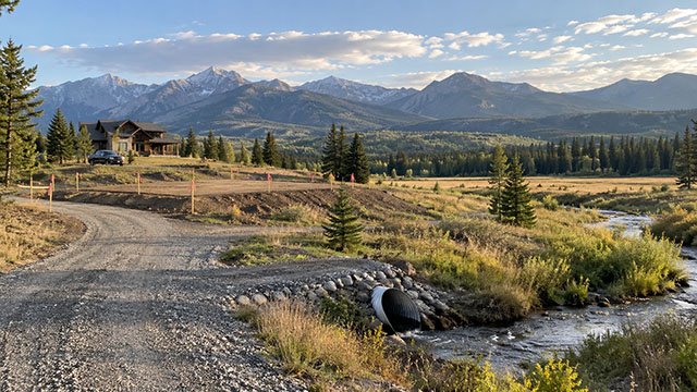
Flood risk should be checked before you fall in love with the homesite
A rural Idaho parcel can look dry, flat, and easy to build on while still containing mapped floodplain, floodway, seasonal drainage, or low areas that affect where a home, shop, driveway, septic system, and utilities can go.
Floodplain issues can change permit requirements, foundation design, grading limits, insurance costs, lender requirements, and even whether a preferred building location is practical.
The safest time to investigate flood risk is during land due diligence, before you close and before the site plan is finalized.
Start with FEMA's official flood maps
FEMA's Flood Map Service Center is the official public source for National Flood Insurance Program flood hazard information.
The Map Service Center provides Flood Insurance Rate Maps, Flood Insurance Studies, the National Flood Hazard Layer, and Letters of Map Change for a specific area.
Search the property by address when possible, then compare the mapped flood zones with the actual parcel boundaries and proposed building area.
Use Idaho's flood hazard resources as a second check
Idaho Department of Water Resources coordinates the National Flood Insurance Program in Idaho and provides a statewide flood hazard map along with floodplain-management resources.
The state map is useful for seeing the broader flood context, but parcel-level decisions should still be based on the effective FEMA mapping, local floodplain administrator, survey data, and current site conditions.
A map screenshot by itself should not be treated as a final buildability determination.
Zone A means the parcel is in a Special Flood Hazard Area
FEMA identifies Zone A as an area subject to the 1-percent-annual-chance flood, also commonly called the base flood or 100-year flood.
In a basic Zone A, detailed hydraulic analysis may not have been completed, so a Base Flood Elevation may not be shown on the map.
That can make site planning more complicated because the project may need additional elevation information before the local floodplain administrator can determine whether the proposed development complies.
Zone AE is also high-risk, but it includes Base Flood Elevations
Zone AE is also within the 1-percent-annual-chance floodplain, but it is mapped using more detailed methods and typically includes Base Flood Elevations.
The Base Flood Elevation is the elevation associated with the mapped base flood and is a key number for building, elevation, and floodplain-compliance decisions.
If a proposed homesite is in Zone AE, the surveyor, engineer, architect, builder, and floodplain administrator should all be working from the same elevation data.
Zone X does not mean zero flood risk
FEMA uses shaded Zone X for areas with moderate flood hazard, including the 0.2-percent-annual-chance floodplain, and unshaded Zone X for areas of lower mapped risk outside the Special Flood Hazard Area.
A Zone X designation can still include local drainage, groundwater, culvert, snowmelt, creek, irrigation, or stormwater problems that do not appear as a mapped FEMA Special Flood Hazard Area.
Use the FEMA map as one layer of due diligence, not the only drainage investigation.
The floodway is more restrictive than the broader floodplain
A regulatory floodway is the part of the floodplain needed to carry floodwater without causing unacceptable increases in flood levels.
Development in the floodway is typically subject to stricter review because fill, structures, walls, grading, and other changes can obstruct or redirect flood flows.
Idaho's floodplain-management forms include procedures for no-rise certification where development is proposed in a regulatory floodway.
A floodplain development permit can apply to more than a house
Floodplain rules apply to development, not just occupied buildings.
FEMA floodplain guidance defines development broadly to include construction, filling, grading, paving, excavation, drilling, land clearing, and storage of equipment or materials.
If part of the acreage lies in a Special Flood Hazard Area, ask the local floodplain administrator which site-work activities require approval before equipment begins work.
The local floodplain administrator is the key permit contact
Idaho Department of Water Resources supports local communities participating in the National Flood Insurance Program, but local floodplain administrators generally handle property-specific floodplain permits and records.
The local administrator can explain the effective map, applicable ordinance, permit process, required elevations, floodway issues, and whether existing Elevation Certificates or map-change documents are on file.
That local review matters because community ordinances can contain requirements that go beyond what a buyer sees on a national map.
Elevation Certificates can answer important property questions
An Elevation Certificate documents elevation information used for floodplain compliance, insurance, and certain map-change requests.
Idaho Department of Water Resources notes that the state does not maintain a statewide database of completed Elevation Certificates for individual properties.
To find an existing certificate, contact the city or county floodplain administrator where the property is located.
An existing house in a flood zone may already have useful records
If the property has an existing home, shop, manufactured home, or other permitted structure, ask for the floodplain permit, Elevation Certificate, engineering, inspection history, and any FEMA Letter of Map Change.
Those records can show how the structure was permitted, what elevation requirements applied, and whether the mapped flood status has changed since construction.
Do not assume the current online map tells the entire permitting history.
A Letter of Map Amendment can matter when natural ground is above the flood level
A Letter of Map Amendment is a FEMA determination that a structure or legally described parcel, or portion of it, is not actually within the mapped Special Flood Hazard Area based on natural ground elevation.
FEMA's LOMA process is often used when a mapped boundary is broad or approximate and survey data shows that the property is naturally above the base flood elevation.
A LOMA does not redesign the property. It documents FEMA's determination based on submitted elevation and location information.
A LOMA is different from changing the land with fill
FEMA distinguishes a Letter of Map Amendment from revisions based on fill or other physical changes.
If soil is placed to raise the building site, a different map-revision process may apply.
Before importing fill into a mapped floodplain, talk with the local floodplain administrator and a qualified engineer or surveyor so the grading plan does not create a compliance problem.
Do not assume a mapped flood boundary follows property lines
Flood zones follow modeled flood risk and topography, not parcel boundaries.
One parcel can contain Zone X, Zone A, Zone AE, and floodway areas at the same time.
The buildable part of the property may therefore be very different from the total acreage shown in a real-estate listing.
A survey can help place the flood zone on the actual site plan
When the mapped flood boundary is close to the planned building area, a surveyor can help relate the FEMA mapping and available elevation data to the parcel.
That is especially valuable when the home, shop, septic reserve area, driveway, or well is near the edge of a flood zone.
The goal is to know the relationship before design work becomes expensive.
The building pad should be evaluated with the driveway
A dry homesite is not enough if the only access road crosses an area that floods regularly.
A driveway through a floodplain can require culverts, elevated sections, erosion protection, or floodplain approval, and it may still become temporarily impassable during high-water events.
Evaluate both the structure location and the full route from the public road to the homesite.
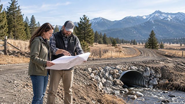
Culverts can change flood behavior
A driveway culvert that is too small, plugged, or poorly aligned can back water up, wash out the road, or redirect flow.
In mapped floodplain or near natural channels, culvert sizing should be coordinated with the road authority, floodplain administrator, and engineer when required.
A cheap culvert installation can become expensive if it causes erosion or fails during snowmelt or a major storm.
Snowmelt and irrigation can create flood problems outside mapped zones
Idaho flood risk is not limited to large rivers.
Rapid snowmelt, hillside runoff, irrigation ditches, canals, drainage swales, small creeks, and blocked culverts can create localized flooding even where the FEMA map shows lower risk.
Visit the property during wet conditions when possible and look for sediment lines, debris deposits, washed gravel, wetland vegetation, bank erosion, and low spots.
Wildfire can increase flood and debris-flow risk
Idaho Department of Water Resources includes post-fire flooding information in its floodplain resources because burned watersheds can respond differently to heavy rain.
Loss of vegetation and soil changes after wildfire can increase runoff, erosion, sediment, and debris movement.
If the parcel sits below a recently burned slope or drainage, flood due diligence should include post-fire watershed conditions rather than relying only on pre-fire assumptions.
Septic planning can be affected by floodplain constraints
A drainfield, replacement area, septic tank, and sewer line all need a location that works with the site's soil, groundwater, setbacks, and flood conditions.
A parcel can have enough total acreage but still be difficult if the high ground is needed for the house while the remaining ground is unsuitable for septic.
Coordinate floodplain and septic due diligence before choosing the final house location.
Well placement should also be evaluated with flood risk
A private well can be vulnerable if floodwater reaches or surrounds the wellhead.
The well location, casing, grading, and drainage around the well should be coordinated with current Idaho well-construction requirements and the site plan.
Keep the well out of obvious drainage paths and confirm applicable setback and construction requirements with the relevant agencies.
Fill in a floodplain is not just ordinary site grading
Bringing in fill can change drainage, reduce flood-storage area, redirect flow, or affect nearby properties.
In mapped floodplain, fill may require engineering, floodplain approval, elevation documentation, or a FEMA map-change process depending on the location and purpose.
Do not let an excavation contractor raise the pad first and ask permitting questions later.
Retaining walls and berms can also redirect water
A wall, berm, raised driveway, or landscaped mound can function like a small levee when floodwater or runoff reaches it.
That can protect one area while pushing water toward another.
If the site is near mapped floodplain or a defined drainage route, include those features in the engineering and permit review.
Manufactured and modular homes still have floodplain requirements
Placing a manufactured or modular home does not avoid floodplain rules.
FEMA and local ordinances can require elevation, anchoring, foundation, utility, and siting standards when a structure is located in a Special Flood Hazard Area.
Confirm those requirements before ordering the unit or finalizing the foundation package.
Flood insurance and floodplain permits are related but separate
A floodplain development permit determines whether a project complies with local floodplain rules.
Flood insurance is a separate financial product and may be required by a lender when a structure securing the loan is in a Special Flood Hazard Area.
A parcel can also have meaningful flood risk even when insurance is not required by a lender.
Ask about flood insurance before you buy, not after you build
Insurance availability and cost can affect the real carrying cost of a rural property.
If the planned home is in or near a mapped flood zone, get an insurance quote based on the actual project and elevation information when available.
Do not assume that a neighbor's premium or an online estimate will match a new structure on your parcel.
Flood map updates can change the property's status
FEMA flood maps are updated over time as new studies, topography, development, and hydrologic information become available.
A property can move into or out of a mapped Special Flood Hazard Area after a map revision.
Ask the local floodplain administrator whether a new study, preliminary map, or map revision is underway before relying only on the currently effective map.
A low-risk map designation should still be paired with drainage due diligence
FEMA maps are designed for floodplain management and insurance, not for identifying every small drainage problem on rural acreage.
A shallow swale, undersized culvert, irrigation overflow, spring, or hillside runoff can create expensive site-work problems without appearing as a Special Flood Hazard Area.
Walk the property with a grading or civil contractor when drainage is a concern.
A practical Idaho flood-risk due-diligence checklist
Use this checklist before removing flood and drainage contingencies from a rural land purchase.
- Search the property in FEMA's Flood Map Service Center
- Review the Idaho flood hazard map
- Identify any Zone A, Zone AE, shaded Zone X, floodway, or other mapped hazard areas
- Contact the local floodplain administrator
- Ask whether a floodplain development permit would apply
- Request any existing Elevation Certificates
- Request prior floodplain permits or map-change documents
- Ask whether preliminary or revised maps are pending
- Compare flood boundaries with the survey and proposed building area
- Check the full driveway route, not just the house pad
- Inspect culverts, ditches, streams, and drainage paths
- Visit during wet or snowmelt conditions when practical
- Look for erosion, sediment, debris lines, or washed-out gravel
- Coordinate floodplain limits with septic and well planning
- Avoid placing fill until floodplain requirements are understood
- Price any elevation, engineering, culvert, or floodproofing work before closing
- Get a flood-insurance quote when the planned structure may be affected
Questions to ask the local floodplain administrator
The local administrator can usually answer the most important permit and mapping questions for the parcel.
- Is any part of this parcel in a Special Flood Hazard Area?
- Is any part in the regulatory floodway?
- Which FEMA map panel and effective date apply?
- Is there a Base Flood Elevation for the site?
- Are there existing Elevation Certificates or floodplain permits?
- Would grading, fill, driveway work, or a new structure require a floodplain development permit?
- Are there local freeboard or elevation requirements above the Base Flood Elevation?
- Is a no-rise certification required for work in the floodway?
- Are revised or preliminary flood maps pending?
- Has the property been affected by prior Letters of Map Amendment or Revision?
Questions to ask a surveyor or engineer
A surveyor or engineer can help translate mapping into actual site elevations and buildability.
- Can you locate the mapped flood boundary relative to the parcel?
- What are the ground elevations at the proposed house and driveway?
- Is an Elevation Certificate recommended?
- Is the site naturally above the Base Flood Elevation?
- Would a LOMA application be reasonable based on natural grade?
- Would proposed fill trigger a different FEMA process?
- Does the driveway or culvert need hydraulic analysis?
- Could a retaining wall, berm, or raised pad redirect floodwater?
- What site changes should be avoided before permitting?
Use AcreageReady's Idaho access, grading, and drainage guides next
Floodplain due diligence should feed directly into the site-development budget.
AcreageReady's Idaho rural property access guide covers driveway permits, private roads, culverts, and easements, while the grading and retaining-wall guides help explain how elevation and drainage work affect the site.
For buyers comparing raw parcels, the Buying Rural Land in Idaho and Build-Ready Land Cost guides tie flood risk into wells, septic, power, access, and total development cost.
The best rural parcel is not always the one with the most acreage
Ten acres with a narrow strip of usable high ground can be harder to develop than five acres with clear access, good drainage, and a simple building envelope.
Flood maps, elevation data, local permit requirements, and on-the-ground drainage conditions all help show how much of the parcel is actually practical for the project.
Treat flood risk as a site-planning issue before it becomes a construction problem.
Keep researching
Acreage Planning resources
Due diligence, development sequencing, utilities, access, and the decisions that shape a rural property project.
Sources & methodology
Where this information comes from
Cost figures are planning references rather than contractor quotes. Permitting, system-selection, and location-specific guidance should be verified with the appropriate local authority or qualified professional. AcreageReady uses source-backed, AI-assisted editorial workflows and remains responsible for the material it publishes. Read how we research, edit, and correct guides.
- FEMA: Flood Map Service Center
- FEMA: Flood Zone Identification
- FEMA: Paper Application Forms for Letter of Map Changes
- FEMA: Letters of Map Revision and Conditional Letters of Map Revision
- Idaho Department of Water Resources: Floodplain Management
- Idaho Department of Water Resources: Floodplain Management Forms
- Idaho Department of Water Resources: Idaho Model Flood Damage Prevention Ordinance
- AcreageReady: Idaho Rural Property Access
- AcreageReady: Rural Driveway Drainage in Idaho
- AcreageReady: Buying Rural Land in Idaho
- AcreageReady: How Much Does It Cost to Make Rural Land Build-Ready in Idaho?
Common questions
Frequently asked questions
Where can I check whether rural Idaho land is in a flood zone?
Use FEMA's Flood Map Service Center for the official National Flood Insurance Program mapping, then compare it with Idaho Department of Water Resources flood-hazard resources and confirm parcel-specific questions with the local floodplain administrator.
What does FEMA Zone A mean?
Zone A is within the Special Flood Hazard Area and is subject to the 1-percent-annual-chance flood. In basic Zone A areas, a Base Flood Elevation may not be shown because detailed hydraulic analysis has not been completed.
What is Zone AE?
Zone AE is also part of the 1-percent-annual-chance floodplain, but detailed analysis has been completed and Base Flood Elevations are typically shown.
Does Zone X mean there is no flood risk?
No. Shaded Zone X represents moderate mapped flood hazard, while unshaded Zone X is lower mapped risk outside the Special Flood Hazard Area. Local drainage, snowmelt, irrigation, and culvert problems can still occur.
Do I need a permit to grade or fill land in an Idaho floodplain?
Possibly. Floodplain development rules can apply to grading, fill, excavation, paving, land clearing, and other development in mapped Special Flood Hazard Areas. Contact the local floodplain administrator before starting work.
What is an Elevation Certificate?
An Elevation Certificate documents structure and ground elevations for floodplain compliance, insurance, and certain FEMA map-change requests. Idaho advises contacting the local community floodplain administrator for existing property-specific certificates.
What is a Letter of Map Amendment?
A LOMA is FEMA's determination that a structure or legally described parcel, or part of it, is naturally above the base flood elevation and should not be shown within the mapped Special Flood Hazard Area.
Can floodplain status affect my septic and driveway layout?
Yes. Floodplain boundaries can constrain the building envelope, driveway route, fill, septic areas, well location, culverts, and other site-development decisions.
Ready to talk with a local professional?
Share your location and project details so AcreageReady can identify relevant providers as the network grows.
Get a free quote