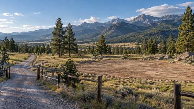
A fence line is not the same thing as a property line
Rural acreage often looks easier to understand than it really is. There may be an old fence, a gravel road, a row of trees, a ditch, or a corner post that appears to define the parcel.
Those physical features can be useful clues, but they do not replace the legal description, recorded survey information, and professional boundary work needed to establish where the property actually lies.
Before buying land, especially when the house, driveway, well, septic system, shop, or future fence will be close to a boundary, verify the parcel instead of assuming the visible occupation line is correct.
Idaho licenses professional land surveyors
Professional land surveying is a regulated profession in Idaho through the Board of Licensure of Professional Engineers and Professional Land Surveyors.
The Idaho Division of Occupational and Professional Licenses provides a public license search so buyers can confirm whether the surveyor they hire holds an active Idaho professional land surveyor license.
For boundary, legal-description, easement, and authoritative location work, use a properly licensed professional rather than relying on an unverified map or informal measurement.
A boundary survey does more than measure acreage
A boundary survey is intended to locate and document the legal boundaries of the property based on deeds, plats, prior surveys, monuments, occupation evidence, and applicable surveying principles.
The surveyor may research county records, recover existing monuments, resolve conflicting evidence, set new monuments when appropriate, and prepare a record showing how the boundary was established.
The final acreage can matter, but the more important result is understanding where the boundary is in relation to roads, structures, fences, easements, utilities, and the planned building envelope.
County GIS maps are useful, but they are not boundary surveys
County parcel maps are excellent tools for early research because they can show parcel shape, assessor data, road context, neighboring ownership, zoning layers, and aerial imagery.
They are not a substitute for a professional land survey. Idaho county GIS systems commonly warn that parcel mapping is maintained for assessment or reference purposes and should not be relied on to determine authoritative property boundaries.
Use GIS to understand the property, then use recorded survey information and a professional land surveyor when exact location matters.
The legal description is the foundation of the parcel
A deed identifies the property through a legal description, which can reference a subdivision lot, metes-and-bounds description, section-township-range system, government lot, or another legally recognized description.
The surveyor uses that description along with recorded documents and physical evidence to locate the parcel on the ground.
If the legal description appears inconsistent with the advertised acreage, mapped parcel, or physical occupation, resolve the discrepancy before closing.
Review the deed and preliminary title report together
The deed tells you what parcel is being conveyed, while the preliminary title report can identify recorded easements, rights-of-way, reservations, restrictions, and other exceptions that may affect the property.
These records should be reviewed together because a parcel can have a clear outer boundary but still contain significant access, utility, irrigation, pipeline, or other easements.
A survey is especially valuable when those recorded rights need to be located on the ground relative to the planned house or improvements.
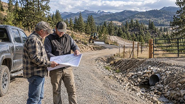
Recorded easements can reduce the usable building area
An easement may allow a road, utility line, ditch, pipeline, drainage feature, or neighboring access route to cross the parcel.
The owner may still own the underlying land, but the easement can limit where permanent structures, fences, grading, or landscaping can be placed.
A rural parcel with ten acres on paper can have a meaningfully smaller practical building envelope after access, utility, septic, floodplain, and other easements are accounted for.
Access easements deserve special attention
If the property does not front a public road, legal access may depend on a recorded easement across neighboring land.
The easement width, route, permitted uses, maintenance obligations, gate rights, and utility language all matter.
Have the surveyor locate the easement when the actual road appears to wander outside the recorded corridor or when future widening, utility trenching, or construction traffic will depend on that route.
Utility easements may not follow the driveway
A common assumption is that electric, communications, or water utilities can simply be placed in the same corridor as the access road.
That is only true when the legal rights and utility requirements support it.
If the property depends on an easement across another parcel, verify whether the easement includes utility rights or whether a separate easement will be needed.
Drainfield easements can require professional surveying
Idaho's 2026 Professional Land Surveying Guidance Document notes that some public health districts require drainfield easements to be located and monumented by a professional land surveyor.
When that kind of field work creates or locates the easement boundary under the conditions described by Idaho law, a Record of Survey may be required.
This is one reason septic planning, easement review, and survey work should be coordinated early on shared or constrained rural properties.
Encroachments can become expensive after closing
An encroachment occurs when a structure, fence, driveway, retaining wall, septic component, landscaping feature, or other improvement crosses a property line or easement boundary.
Some encroachments have existed for years without conflict, but that does not make them harmless.
A survey can identify apparent encroachments before the buyer inherits the problem, giving the parties time to clarify ownership, obtain agreements, adjust the purchase terms, or address the issue before closing.
Old fences can be informative without being controlling
Fences often reflect historic use, livestock management, convenience, terrain, or agreements between previous owners.
They may follow the property line closely, but they may also wander around trees, rock, streams, or easier terrain.
Treat a fence as evidence to be considered by the surveyor, not as proof of the legal boundary.
Property corners can be difficult to find
Boundary monuments may be rebar, pipes, capped rods, brass caps, stones, buried markers, or other survey monuments depending on when and how the parcel was created.
Some are visible. Others are buried, disturbed, obscured by vegetation, paved over, or missing.
A metal detector and a guess are not a substitute for professional retracement because the significance of a found object depends on the recorded evidence and the surveyor's analysis.
Do not move a survey monument
Survey monuments are part of the legal and physical evidence used to establish land boundaries.
Construction, grading, fence installation, driveway work, and paving can disturb or destroy them if the crew does not know where they are.
If a monument is near planned construction, have a professional land surveyor locate it before work starts so it can be protected or properly reestablished if required.
Idaho has specific corner-record filing requirements
Idaho law requires professional land surveyors to file corner records for certain public land survey corners and related control monuments when they are established, reestablished, rehabilitated, or used in specified ways.
These records are filed with the county clerk and recorder where the corner is located and become part of the public survey record.
They can be important research sources for later surveyors retracing nearby rural property.
Records of Survey are filed with the county recorder in certain situations
Idaho's Recording of Surveys law requires a Record of Survey to be filed when specified conditions occur.
Examples include a survey that discloses a material discrepancy with previous surveys, establishes boundary lines or corners not previously of record, sets monuments at corners that were not previously monumented, or creates certain easement or lease-area monuments.
The filing requirement helps preserve the survey evidence for future owners, surveyors, and public agencies.
Idaho generally requires qualifying Records of Survey within 90 days
Under Idaho Code section 55-1904, a qualifying Record of Survey is generally filed within 90 days after completion of the survey.
The county recorder assigns the filed survey an instrument number and maintains it with other survey records.
When buying land, ask the surveyor or county recorder whether prior Records of Survey exist for the parcel or surrounding sections.
Not every field survey creates a Record of Survey
Idaho law also identifies situations where a Record of Survey is not required.
Preliminary surveys, some surveys associated with another recorded map, and certain topographic or construction surveys that do not trigger boundary-related conditions can fall outside the filing requirement.
The professional land surveyor determines the appropriate work product and filing obligations based on the actual scope and findings.
County survey records can be extremely useful before ordering new work
Before field work begins, surveyors often research prior plats, Records of Survey, corner records, deeds, right-of-way documents, and other recorded information.
Some Idaho counties make survey documents available through online mapping or document systems, while others require recorder or surveyor-office research.
A prior survey does not always eliminate the need for a new survey, but it can provide valuable evidence and sometimes reduce field research time.
A prior survey does not automatically answer today's question
A twenty-year-old survey may accurately document the boundary while still failing to show today's fence, driveway, shop, utility line, or other improvements.
The parcel may also have been affected by later easements, boundary adjustments, subdivision activity, road changes, or construction.
Use the prior survey as evidence, then decide whether an updated boundary or improvement survey is needed for the current transaction.
Topographic surveys solve a different problem
A topographic survey maps ground elevations and physical features such as slopes, contours, roads, drainage, structures, and sometimes utilities or vegetation.
It is valuable for grading, drainage, retaining walls, house-pad design, engineering, and site planning.
A topographic survey is not automatically a boundary survey. If both precise boundary and elevation information are needed, make sure the survey scope includes both.
Construction staking is not the same as boundary work
Construction staking transfers the approved plans onto the ground so contractors know where to build foundations, roads, utilities, walls, or other improvements.
It depends on having reliable project control and often on a verified boundary or site plan.
Do not ask a contractor to stake a home from a county GIS map when setbacks or easements make exact placement important.
Survey first when the house will sit close to a setback
A rural parcel may feel spacious but still have a tight building envelope because of road setbacks, side and rear setbacks, septic areas, floodplain, steep slopes, easements, and utility corridors.
When the building is close to any constraint, survey the relevant boundary before excavation or foundation work begins.
Moving stakes is inexpensive compared with moving a foundation.
Surveying is especially important before building a fence
A long acreage fence can represent a major investment in posts, wire, gates, clearing, and labor.
If the fence is intended to follow the legal property boundary, have the line established before construction.
A fence built several feet onto neighboring land can create a long-term problem even when the original mistake was unintentional.
Rural roads can drift outside recorded easements
Private roads often evolve over time as owners avoid mud, trees, snow, washouts, or steep sections.
The traveled road can gradually move away from the recorded access easement.
If the route is essential to the property, compare the actual road with the recorded easement before buying and determine whether corrective documents or road relocation are needed.
Shared driveways need both boundary and easement clarity
A shared driveway may cross several parcels before reaching the homesite.
The survey should help clarify where the shared route lies relative to parcel boundaries and recorded access rights.
The title documents should separately address who can use the road, who maintains it, and whether utilities can share the corridor.
Irrigation ditches and canals can complicate boundaries
Idaho rural properties frequently contain canals, laterals, ditches, drains, or irrigation easements.
The visible water feature may not sit exactly on the parcel boundary, and the irrigation entity may hold access or maintenance rights extending beyond the ditch itself.
Review recorded irrigation rights and locate important easements before placing fences, gates, landscaping, or structures nearby.
Waterfront property deserves extra boundary research
Parcels near rivers, creeks, reservoirs, or other water features can involve changing channels, meander lines, riparian rights, floodplain, and more complex legal descriptions.
The visible shoreline should not be assumed to be the surveyed property boundary.
When waterfront acreage is a major reason for the purchase, use a land surveyor and qualified legal counsel familiar with the specific title and water-boundary issues.
Acreage advertised in a listing can be approximate
Real-estate listings often repeat acreage from assessor records, prior deeds, subdivision plats, or seller information.
Those numbers are useful for marketing and screening but should not replace the controlling legal description and survey evidence.
If exact acreage affects value, development density, livestock plans, financing, or subdivision potential, verify it before closing.
A survey can reveal problems that a title search cannot show by itself
Title records are essential, but they do not always show the current physical relationship between legal rights and improvements on the ground.
A survey can reveal an apparent fence encroachment, driveway outside an easement, building near a boundary, unrecorded occupation line, or utility feature that deserves further investigation.
The strongest due diligence combines title research and field evidence rather than treating either one as complete by itself.
A survey can also confirm that the property is straightforward
Not every survey uncovers a problem.
A clear boundary with recovered monuments, consistent records, no material encroachments, and well-located easements can give a buyer confidence before making major site-development investments.
That certainty has value when the next steps include clearing, driveway construction, drilling a well, installing septic, or building a home.
Order survey work early enough to affect the purchase decision
Surveyors can have scheduling backlogs, especially during active construction seasons.
Research, field work, monument recovery, neighbor coordination, and record preparation can take longer than buyers expect.
If a survey is important to the transaction, order it early in the due-diligence period rather than waiting until the closing date is approaching.
Give the surveyor the title documents before field work
Provide the surveyor with the current deed, preliminary title report, recorded easement documents, prior surveys, plats, and any specific concerns you already know about.
That helps the surveyor understand the transaction and research the relevant record evidence before visiting the site.
If the buyer is concerned about a particular fence, access road, shop, or neighbor improvement, identify that issue when requesting the scope.
Make the survey scope match the decision you need to make
A simple boundary retracement, full boundary and topographic survey, construction staking package, easement survey, and ALTA/NSPS Land Title Survey are different products.
Do not choose a survey solely by price without explaining what the buyer, lender, title company, engineer, or builder actually needs.
A professional land surveyor can recommend the appropriate scope once the purpose is clear.
Verify the surveyor's Idaho license
The Idaho Board of Licensure of Professional Engineers and Professional Land Surveyors maintains a public license-search system through DOPL.
Check the professional land surveyor's license before hiring, particularly when the work will establish boundaries, prepare legal descriptions, or support recorded documents.
The Board also publishes current statutes, rules, and a Professional Land Surveying Guidance Document for licensees and the public.
Ask for a written scope and fee proposal
Survey costs can vary significantly with parcel size, terrain, vegetation, access, record quality, number of corners, monument condition, and complexity of the legal description.
A wooded mountain parcel with missing corners and conflicting records can require much more work than a recently platted lot with clear monuments.
Ask what research, field work, monument setting, drafting, recording, travel, and additional services are included in the quoted fee.
A fixed price may still have assumptions
Some surveyors provide fixed fees, while others use hourly rates or a base fee with additional charges if unusual conditions appear.
If the proposal assumes existing monuments can be recovered or prior records are adequate, ask what happens if those assumptions are wrong.
Knowing the change conditions up front makes the final invoice easier to understand.
Do not ask a contractor to settle a boundary disagreement
Excavators, fence contractors, builders, and real-estate agents can help identify practical concerns, but they are not substitutes for a professional land surveyor when the legal boundary is uncertain.
If neighbors disagree about ownership or legal rights, the issue can also require legal advice beyond the survey itself.
Keep surveying, construction, title, and legal responsibilities clearly separated.
Survey monuments should be shown to the contractors who need them
Once the survey is complete, make sure the site superintendent, excavator, driveway contractor, fence crew, and other relevant trades know where critical monuments and boundaries are.
Protecting them is much easier than reconstructing them after clearing or grading.
Temporary stakes can be replaced during construction, but permanent survey monuments should not be casually removed or relocated.
A practical Idaho land-survey due-diligence checklist
Use this checklist before closing on rural Idaho land when boundaries, access, easements, or development space matter.
- Obtain the current deed and legal description
- Review the preliminary title report
- Collect all recorded access, utility, irrigation, drainage, and other easements
- Search county records for prior plats and Records of Survey
- Search for relevant corner records where available
- Compare the assessor or GIS map with the legal documents
- Do not treat GIS parcel lines as authoritative boundaries
- Walk the property and note fences, roads, structures, ditches, and apparent corners
- Identify any improvements close to a boundary or easement
- Confirm legal access to the property
- Check whether the traveled road matches the recorded access corridor
- Verify the Idaho license of the professional land surveyor
- Give the surveyor the title report and prior survey documents
- Define whether you need boundary, topographic, easement, or construction survey work
- Resolve material discrepancies before closing
- Protect recovered or newly set monuments during construction
- Coordinate the survey with septic, well, access, floodplain, and building-site planning
Questions to ask an Idaho land surveyor
A clear conversation at the beginning helps the surveyor scope the work correctly.
- What type of survey do you recommend for this purchase?
- Have you worked in this township, subdivision, or county before?
- Are prior Records of Survey available?
- Do you expect the existing property corners to be recoverable?
- Will you set or replace monuments if required?
- Will a Record of Survey need to be filed?
- Can you locate recorded access and utility easements?
- Can the scope include fences, buildings, roads, wells, septic areas, or other improvements?
- Do I also need topographic information for the planned house site?
- What records should I provide before you begin?
- What is included in the quoted fee?
- What conditions could increase the cost?
- How long should the work take?
- What final documents and digital files will I receive?
Questions to ask the title company
Survey and title work should support each other during rural-land due diligence.
- Which recorded easements affect the parcel?
- Are there access exceptions or unresolved right-of-way issues?
- Does the title commitment require a survey for any coverage or exception removal?
- Are there recorded boundary-line adjustments or subdivision plats?
- Are there documents referenced in the title report that are not attached?
- Does the legal description match the deed and current vesting?
- Should any survey issue be addressed before closing?
Tie the survey into the rest of the Idaho development plan
Surveying provides the framework that many other site-development decisions depend on.
AcreageReady's Idaho rural property access guide helps evaluate private roads and easements, the septic guide covers reserve areas and setbacks, and the flood-zone guide explains how mapped flood hazards can further constrain the building envelope.
The Buying Rural Land in Idaho guide brings those issues together for buyers comparing undeveloped parcels.
The best time to find a boundary problem is before closing
Boundary and easement issues become much harder to ignore after the house design, driveway, fence, or utility route is already based on the wrong assumption.
A professional survey gives the buyer a defensible picture of where the parcel is and how recorded rights relate to the land on the ground.
For rural Idaho acreage, that can be one of the most valuable pieces of due diligence you complete before construction begins.
Keep researching
Acreage Planning resources
Due diligence, development sequencing, utilities, access, and the decisions that shape a rural property project.
Sources & methodology
Where this information comes from
Cost figures are planning references rather than contractor quotes. Permitting, system-selection, and location-specific guidance should be verified with the appropriate local authority or qualified professional. AcreageReady uses source-backed, AI-assisted editorial workflows and remains responsible for the material it publishes. Read how we research, edit, and correct guides.
- Idaho DOPL: Board of Professional Engineers and Land Surveyors
- Idaho DOPL: Statutes, Rules and Guidance for Engineers and Land Surveyors
- Idaho DOPL: Professional Land Surveying Guidance Document, May 27, 2026
- Idaho DOPL: Professional Land Surveying Manual and Guidance
- Idaho Code: Recording of Surveys, Title 55 Chapter 19
- Idaho Code 55-1904: Records of Survey - When Filing Required
- Idaho Code 55-1604: Corner Record Filing Requirements
- Canyon County GIS User Guide
- Ada County Corner Record Mapping Help
- AcreageReady: Idaho Rural Property Access
- AcreageReady: Idaho Septic Permits & Site Evaluations
- AcreageReady: Idaho Flood Zones & Rural Land
- AcreageReady: Buying Rural Land in Idaho
Common questions
Frequently asked questions
Do I need a land survey before buying rural property in Idaho?
A survey is not necessary for every transaction, but it is especially valuable when boundaries are unclear, access depends on easements, improvements sit near property lines, acreage matters to the purchase, or significant construction is planned.
Can I use an Idaho county GIS map to find my property line?
County GIS maps are useful for general reference but should not be treated as authoritative property boundaries. Exact boundary location should be determined from legal records and professional surveying when needed.
Who can perform authoritative land surveying in Idaho?
Authoritative professional land surveying must be performed under the responsible charge of an Idaho-licensed professional land surveyor when the work falls within the regulated practice defined by Idaho law.
Does Idaho require Records of Survey to be filed?
Idaho law requires a Record of Survey in specified situations, including certain new or previously unrecorded boundaries, material discrepancies, newly monumented corners, and qualifying easement or lease-area surveys.
How quickly must a qualifying Idaho Record of Survey be filed?
Idaho Code section 55-1904 generally requires qualifying Records of Survey to be filed within 90 days after the survey is completed.
Can an old fence establish my Idaho property line?
An old fence can be relevant evidence, but it should not automatically be assumed to be the legal boundary. A professional land surveyor evaluates deeds, plats, monuments, prior surveys, occupation evidence, and other controlling information.
Should I survey before building a fence or driveway?
Yes when the improvement is intended to follow or stay close to a property line or easement. Establishing the boundary first is usually far less expensive than relocating completed construction.
How do I verify an Idaho land surveyor's license?
Use the Idaho Division of Occupational and Professional Licenses public search for the Board of Professional Engineers and Land Surveyors.
Ready to talk with a local professional?
Share your location and project details so AcreageReady can identify relevant providers as the network grows.
Get a free quote