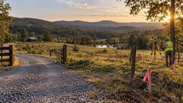
Property lines are one of the easiest rural land assumptions to get wrong
A fence line, tree line, old road, creek, mowing edge, or row of posts can look like an obvious property boundary and still be wrong.
On rural Tennessee acreage, a boundary mistake can affect the homesite, driveway, septic layout, well location, fencing, timber, pasture, future subdivision plans, and even whether the parcel has the road frontage you thought you were buying.
A survey is not just paperwork for closing. It is one of the main tools for understanding what land you actually own and what legal or physical conditions affect it.
Start with the deed, legal description, and recorded plat
Before ordering a new survey, collect the property's current deed, legal description, and any recorded subdivision plat or prior survey that can be located.
The deed identifies the legal property interest being transferred, while the legal description and plat may reference bearings, distances, monuments, adjoining owners, roads, easements, or prior recorded instruments.
These documents give the surveyor a starting point, but they should not be treated as a substitute for current field work when boundary certainty matters.
A GIS parcel map is useful, but it is not the same thing as a boundary survey
Tennessee provides online GIS mapping resources, and many counties also publish assessor or parcel maps that are useful for research.
These maps can help you understand the general shape of a tract, nearby parcels, roads, tax identifiers, and approximate acreage.
They should not be used to place a house, fence, driveway, septic system, or other improvement directly on a presumed property line. For construction and boundary decisions, rely on a licensed land surveyor and the applicable recorded documents.
Tennessee regulates professional land surveyors
Professional land surveying in Tennessee is regulated by the State Board of Examiners for Architects, Engineers, and Land Surveyors.
The state maintains licensing requirements for professional land surveyors and provides a public license-verification process.
When hiring a surveyor, verify that the individual or firm is properly licensed and ask whether they regularly work with rural boundary, acreage, and construction-layout projects.
Not every survey answers the same question
The word survey can refer to different types of work, so buyers should ask exactly what the surveyor will provide.
A basic boundary survey focuses on locating and documenting property boundaries. Other services may include topographic data, construction staking, elevation work, subdivision layout, ALTA/NSPS work, or mapping for easements and improvements.
For a rural buyer, the right scope depends on what you plan to build and which risks need to be resolved before closing.
Boundary monuments matter more than visual assumptions
Professional surveyors look for evidence such as iron pins, pipes, stones, marked trees, old monuments, road references, fences, and other features that may relate to the legal boundary.
A monument found in the field still has to be interpreted in the context of deeds, plats, prior surveys, adjoining ownership, and applicable surveying standards.
Do not move, replace, or install your own boundary markers based only on a phone app or online map.
Old fences can be important evidence without being the legal line
Rural Tennessee parcels often have fences that have been in place for decades.
Those fences may have been built for livestock convenience, terrain, access, or an informal understanding rather than directly on the deed line.
If a fence appears inconsistent with the surveyed boundary, ask the surveyor and title professional what documentation exists before assuming the fence controls ownership.
Creeks and roads do not always define the boundary the way you expect
A creek, ditch, centerline, road edge, right-of-way, or old roadbed may appear in a deed description, but the legal effect depends on the wording of the documents and the survey evidence.
Do not assume ownership extends to the center of a road or stream, or stops at the visible pavement or bank.
If a road or water feature forms part of the boundary, have the surveyor explain exactly what the plat shows.
Verify legal road frontage, not just physical access
A driveway can physically reach a parcel even when the legal access situation is complicated.
The survey should help establish whether the tract directly touches a public road, how much frontage it has, and whether access depends on an easement across another property.
This matters for building permits, future subdivision, utilities, financing, emergency access, and resale.
Recorded easements can change how you use the land
Utility, access, drainage, pipeline, transmission, and other easements can cross rural acreage and affect where improvements can be placed.
The title commitment may identify recorded easements, while a survey can help show where those easements lie in relation to the property.
Pay particular attention to easements near the planned house, driveway, septic area, shop, pond, gates, or future building sites.
Unrecorded or poorly documented access deserves extra attention
Some rural properties are reached by old farm roads, shared gravel drives, or routes that have been used for years without clear documentation.
Visible use is not the same as a recorded, insurable access right.
If access crosses another parcel, ask the title company or real-estate attorney to confirm the legal basis for that access and have the survey show the route when appropriate.
Encroachments are easier to solve before closing
A survey may reveal that a fence, barn, shed, driveway, retaining wall, pond, utility line, or other improvement crosses a property line.
Even a small encroachment can become a financing, title, insurance, neighbor, or future-construction issue.
If one appears, resolve it during due diligence through the appropriate legal, title, or survey process rather than inheriting an unclear problem.
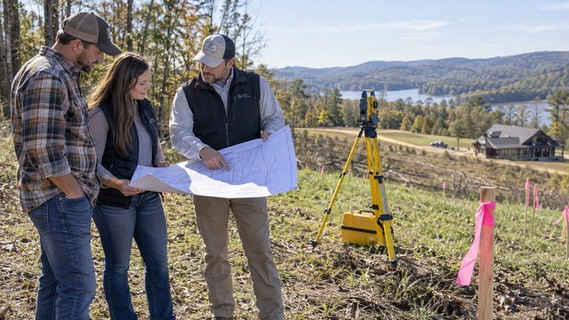
Acreage on the listing may not match surveyed acreage
Real-estate listings, tax records, GIS systems, older deeds, and surveys can show slightly different acreage numbers.
The difference may be minor, or it may reveal that the tract is not the size you expected.
For buyers who need a minimum acreage for livestock, zoning, septic, subdivision, financing, or personal goals, the surveyed acreage can be far more important than the rounded number in a listing.
Irregular parcel shapes can reduce usable acreage
Ten acres on paper does not always mean ten acres of equally usable land.
A narrow frontage, long flag stem, angled boundary, road right-of-way, easement corridor, creek, steep slope, or odd corner can reduce the practical building envelope.
Review the surveyed shape together with the zoning setbacks, septic areas, floodplain, driveway, and utility plan.
A survey should be part of homesite planning
The house location should not be finalized until you understand the actual boundaries and setback reference points.
A preliminary site plan based on reliable boundary information can show whether the home, garage, shop, septic reserve area, well, driveway, pool, and other improvements fit comfortably.
This is especially important on parcels that are narrow, irregular, heavily wooded, sloped, or crossed by easements.
Septic planning depends on knowing where the property really is
Septic systems require enough suitable land for the approved disposal area and reserve area, and those areas need to fit within the tract while maintaining required separation from other site features.
Tennessee septic applications ask for a property sketch showing property lines, the house site, well, driveway, and utilities.
A boundary mistake can therefore affect much more than a fence. It can disrupt the entire development plan.
Wells should not be planned against an uncertain boundary
A rural water well needs to be coordinated with the septic system, homesite, driveway, power, and neighboring property.
If the proposed well location is near a boundary, make sure the property line is reliable before drilling.
Moving a planned well on paper is easy. Correcting a drilled well or a site layout built around the wrong boundary is not.
Timber and clearing decisions can create boundary disputes quickly
Wooded Tennessee acreage can make boundary lines difficult to see on the ground.
If you plan to clear trees, create a view, establish pasture, install a fence, or cut timber near an uncertain line, survey the boundary first.
The cost of a survey is small compared with a dispute over trees or improvements placed on neighboring land.
Existing survey pins may still need professional verification
Finding an iron pin with a metal detector or seeing a marked corner does not automatically prove that you have correctly identified the parcel.
Pins can be disturbed, unrelated to the tract, or part of a prior division.
Let the surveyor determine which monuments control and how they relate to the current deed and adjoining parcels.
Ask whether the survey will show visible improvements and easements
Before accepting a quote, tell the surveyor why you need the survey.
If you want the plat to show fences, driveways, buildings, utility features, easements, creeks, or other improvements, confirm that those items are included in the scope.
A low quote may not include every feature you expect.
Survey cost depends heavily on the property
There is no reliable statewide flat price for a rural Tennessee boundary survey.
Cost can vary with acreage, terrain, vegetation, parcel shape, quality of deed records, availability of prior monuments, travel, adjoining parcel complexity, and the amount of field and research work required.
A small rectangular tract with good records can be much easier than a large wooded parcel with old descriptions and missing monuments.
Survey timing can affect your closing schedule
Good rural surveyors can have busy schedules, and difficult parcels can take longer than expected.
Order the survey early enough in the due-diligence period to allow time for field work, research, questions, and correction of any title or boundary issue that appears.
Do not wait until a few days before closing if the purchase depends on confirming acreage, access, or buildability.
Ask the title company what survey coverage it needs
Title insurance and lender requirements can vary by transaction.
Ask the title company whether an existing survey can be accepted, whether a new survey is recommended, and what exceptions will remain if no current survey is provided.
The survey and title commitment should be reviewed together because one shows physical conditions while the other identifies recorded legal interests and exceptions.
Future subdivision plans make survey work even more important
If you hope to split acreage later for children, relatives, resale, or investment, tell the surveyor and planning office before placing the first house.
Road frontage, parcel shape, easements, septic suitability, zoning, and subdivision requirements can determine whether future lots are practical.
A homesite placed without considering future boundaries can make an otherwise workable subdivision difficult.
Questions to ask a Tennessee land surveyor before hiring
A clear scope helps prevent surprises and makes quotes easier to compare.
- Are you currently licensed as a Professional Land Surveyor in Tennessee?
- Do you regularly survey rural acreage in this county?
- Is this quote for a full boundary survey?
- Will you research the deed, prior plats, and adjoining deeds as needed?
- Will property corners be marked or reset where appropriate?
- Will the final plat show easements that can be located from the available records?
- Will you show visible fences, roads, driveways, buildings, or encroachments?
- Can you provide a digital copy of the completed plat?
- How long do you expect the work to take?
- What conditions could increase the quoted cost?
Rural Tennessee survey due-diligence checklist
Before your inspection or due-diligence period expires, work through the property documents and physical site together.
- Obtain the current deed and legal description
- Locate any prior recorded plat or survey
- Review the county or state GIS parcel map for general orientation
- Verify the surveyor's Tennessee license
- Confirm actual road frontage and legal access
- Locate recorded access and utility easements
- Identify visible fences and possible encroachments
- Compare listed acreage with the surveyed result
- Confirm the usable building envelope
- Coordinate boundaries with zoning setbacks
- Coordinate boundaries with septic and well locations
- Review the survey with the title commitment
- Resolve material discrepancies before closing
- Keep the final survey with your permanent property records
Know the lines before you spend money developing the land
Rural property development works best when the boundary is treated as a foundation for the rest of the site plan.
Before paying for clearing, a driveway, septic installation, a well, fencing, utilities, or a home foundation, make sure you know where the property begins and ends and what easements or access rights affect it.
A reliable survey gives you a much stronger basis for deciding whether a Tennessee parcel supports the project you actually want to build.
Keep researching
Acreage Planning resources
Due diligence, development sequencing, utilities, access, and the decisions that shape a rural property project.
Sources & methodology
Where this information comes from
Cost figures are planning references rather than contractor quotes. Permitting, system-selection, and location-specific guidance should be verified with the appropriate local authority or qualified professional. AcreageReady uses source-backed, AI-assisted editorial workflows and remains responsible for the material it publishes. Read how we research, edit, and correct guides.
- Tennessee State Board: Professional Land Surveyor
- Tennessee State Board: Architects, Engineers & Land Surveyors
- Tennessee State Board: Land Surveyor Forms and Boundary Plat Resources
- Tennessee STS GIS: Mapping Applications and Property Map Viewer
- AcreageReady: Buying Rural Land in Tennessee
- AcreageReady: Tennessee Septic Permits & Soil Evaluations
- AcreageReady: Tennessee Zoning & Building Permits
- AcreageReady: Tennessee Rural Power
Common questions
Frequently asked questions
Do I need a land survey before buying rural property in Tennessee?
A survey is not required in every cash real-estate transaction, but it is often one of the most useful due-diligence tools for rural acreage. It can confirm boundaries, acreage, road frontage, visible encroachments, and the relationship between the property and recorded easements.
Can I use a Tennessee GIS map to locate my property lines?
GIS parcel maps are useful for general research and orientation, but they should not replace a professional boundary survey when you are placing improvements, fencing, clearing near a line, or resolving ownership questions.
Who can perform a boundary survey in Tennessee?
Professional land surveying is regulated by the Tennessee State Board of Examiners for Architects, Engineers, and Land Surveyors. Verify the surveyor's current Tennessee license before hiring.
Is an old fence the legal property line?
Not necessarily. A fence can be relevant evidence, but it may have been installed for convenience rather than on the deed line. A licensed surveyor should evaluate the deeds, plats, monuments, adjoining ownership, and field evidence.
What if the surveyed acreage is different from the listing?
Review the difference with the surveyor, title company, and your real-estate professional before closing. The importance of the discrepancy depends on the contract, legal description, intended use, zoning, septic needs, financing, and other factors.
Can a survey show easements?
A survey can show easements that are identified in the records and can be located on the ground from the available description. Coordinate the survey with the title commitment so recorded easements are reviewed together.
Should I survey wooded property before clearing trees?
Yes, especially when clearing will occur near an uncertain boundary. Wooded acreage can make old lines difficult to identify, and removing trees on neighboring land can create serious disputes.
When should I order the survey during a land purchase?
Order it early in the due-diligence period. That gives you time to receive the field work and plat, investigate discrepancies, and resolve access, acreage, easement, or encroachment issues before closing.
Ready to talk with a local professional?
Share your location and project details so AcreageReady can identify relevant providers as the network grows.
Get a free quote